Statistics of extreme rainfall events over the road network
 Rainfall patterns over NL from radar data
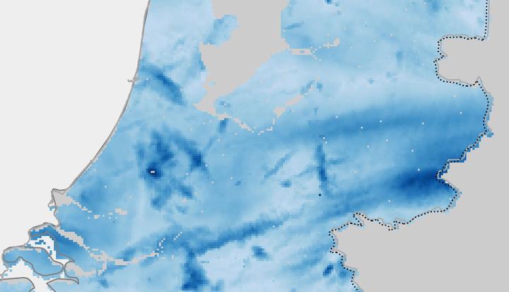
Short-duration extreme rainfall events have the potential of causing problems with a high-impact for the road infrastructure and its correct operation. This is why national agencies maintaining the road networks are interested in getting a statistical description for severe downpours, so they can manage the current infrastructure and new constructions keeping the chances of being affected by extreme rainfall low. Previous works have tackled this type of analysis providing results for a single point. However, in this project we consider the spatial dimension in two ways: we provide statistics for the road network; we simulate the rain clouds to obtain robust statistics. To do this, we took eleven years of radar precipitation data (Overeem et al., 2009a, 2009b) and we computed the maximum rainfall period for short (15-60 minutes) and long (2h-24h) durations. We fitted Generalized Extreme Value (GEV) distributions to the data and we obtained the return period of the short/long term extreme rainfall events for the road network.
Additional information
References
Overeem, A., Buishand, A., Holleman, I. (2009a), Extreme rainfall analysis and estimation of depth-duration-frequency curves using weather radar, Water Resour. Res. 45, W10424. https://doi.org/10.1029/2009WR007869
Overeem, A., Holleman, I., Buishand, A. (2009b), Derivation of a 10-Year Radar-Based Climatology of Rainfall. J. Appl. Meteor. and Climatology, 48, 1448-1463. https://doi.org/10.1175/2009JAMC1954.1
Irene Garcia-Marti
PhD Data Scientist
I have a keen interest in applying machine learning methods in the field of spatio-temporal analytics.